Box UK's "For the Social Good" Hackday and webapp "Gritly"
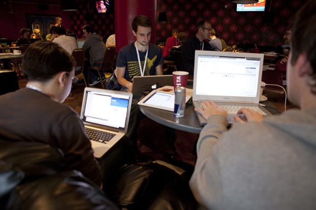
I spent last Sunday at Box UK’s “For the Social Good” hackathon. It was a very successful event and big thanks to Box UK for putting it on and providing a venue, food, and prizes. Over five teams hacked together apps on the broad theme of “social good” (something of benefit to the local community) in eight hours. Check out this post on Box UK’s blog for more information.
Mark Greenwood, Martin Chorley, and I formed the “Cardiff University PhD students” team and built ‘Gritly’, a winter road condition maps mashup (more information below). Cardiff University did very well at the event, with Computer Science undergraduates winning runner up team and individual hacker prizes, and our own Gritly winning the first prize! It was great to see the apps everyone had built. Here are a few write-ups from elsewhere:
- John Greenaway was one of the judges and covers the whole event.
- Henry Hoggard talks about his team’s app, ‘NoteSlide’.
- Craig Marvelley on building ‘Explore Cardiff’.
Gritly
Mark, Martin, and I decided to put a team in and spent an hour last week brainstorming some ideas for a project. We’d decided on using a data.gov.uk dataset in some way and needed an idea for something that could benefit the local community. I’d had the phrase “Winter is Coming” rattling around in my head for a while because, well, Winter is coming. Also, and more relevantly, it’s the time of year where UK news outlets do the usual winter weather doomforecasting. (OK, Game of Thrones too.) From this we edged towards the idea of trying to manage winter weather road hazards (i.e., ice and snow) by either notifying the council of areas that need more gritting (hence the name ‘Gritly’) or at least warning drivers of roads that may be hazardous during very cold spells.
We found a very fine-grained data.gov.uk dataset of a few years' road traffic accidents which includes information on the road and weather conditions at time of incident, and so decided on using this to build a Google Maps mashup that would plot the locations of road accidents where ice or snow were factors. The dataset also provides the date and severity of an incident (from ‘low’ up to ‘fatal’), which the webapp can display. Since the data.gov.uk data on accidents is only provided annually we wanted to also include a realtime component. For this we took inspiration from the #UKSnow twitter mashup and decided that people could submit current road hazards by tweeting a post code and warning along with the hashtag #UKIce.
On the day, Mark handled the Twitter realtime component, Martin designed and implemented the web frontend, and I built the backend and data endpoints and handled deployment. I also did minor processing on the accidents dataset to extract the cold-weather related events and prepare it to be served. The code is available on GitHub here. The backend is written in Python and runs on Django. The realtime component uses tweepy to grab the relevant tweets and geopy to geocode the post codes. The front end is bootstrap, Google’s maps JS library, and a bit of jQuery.
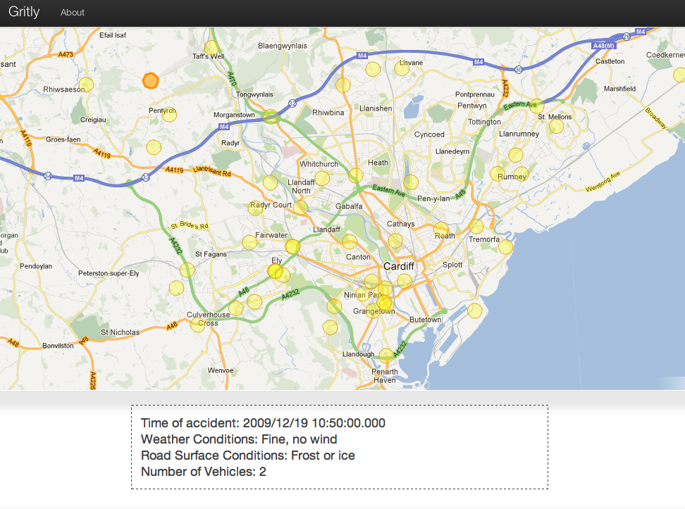
You can visit Gritly at http://gritly.nomovingparts.net/.
It was great fun to build and we managed the project very well, finishing with a relieving 30 minutes to spare. We were also pleased to take the first-place group prize at the event – thanks to Box UK for the Amazon vouchers!
Check out Mark’s and Martin’s write-ups here and here, respectively. Gritly’s has since been covered in a few other places as well: